Wednesday, November 28, 2012

High School Park Misstep


Last year, I was invited to serve on an ad hoc advisory committee for a small park in a neighboring municipality.  I've posted about this park and my role on the committee before.  The park was created when the municipality's old high school was demolished and the grounds dedicated for open space.  The high school building was located on a flat plateau at the top of a steep, wooded slope above a creek.  The school site, the wooded hillside, and the riparian zone along the creek were all incorporated into the parkland.  The mostly-volunteer Friends of High School Park have been working to control invasive non-native plants on the property, which encompasses about 15 acres, and to introduce native species.  Until recently, their restoration work was unchallenged by white-tailed deer, but now deer have moved up the stream corridor and "buck rubbing" damage is evident throughout the park.
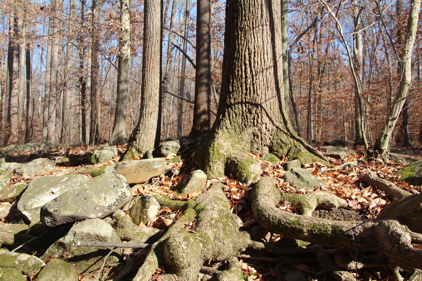
A cluster of trees at the edge of the slope in late afternoon light
The park is surrounded on all sides by dense upper middle class and professional class suburban development.  This inner-ring community was one of the first suburban neighborhoods developed when the interurban trolley and light rail lines were extended into the countryside outside Philadelphia.
There be dragons in these woods!
Late in the afternoon of November 14, the advisory committee met in the park to review progress on improvements funded with a state-funded open space stewardship grant.  When the school was first demolished, the Friends had tried to establish a native, warm-season grassland on the site, but the alkaline soils (from the residual mortar between the bricks) made short work of those efforts, and the grassland quickly transmogrified into an unsightly weedy mess.  So, the Friends applied for a state grant to try to do the job right.  They hired a grassland establishment expert for suggestions for appropriate plant material and soil amendments.  And, because the park is heavily used by the neighbors, they incorporated cultural amenities such as landscaped gardens (using exclusively native plants), paths, and interpretive signage.

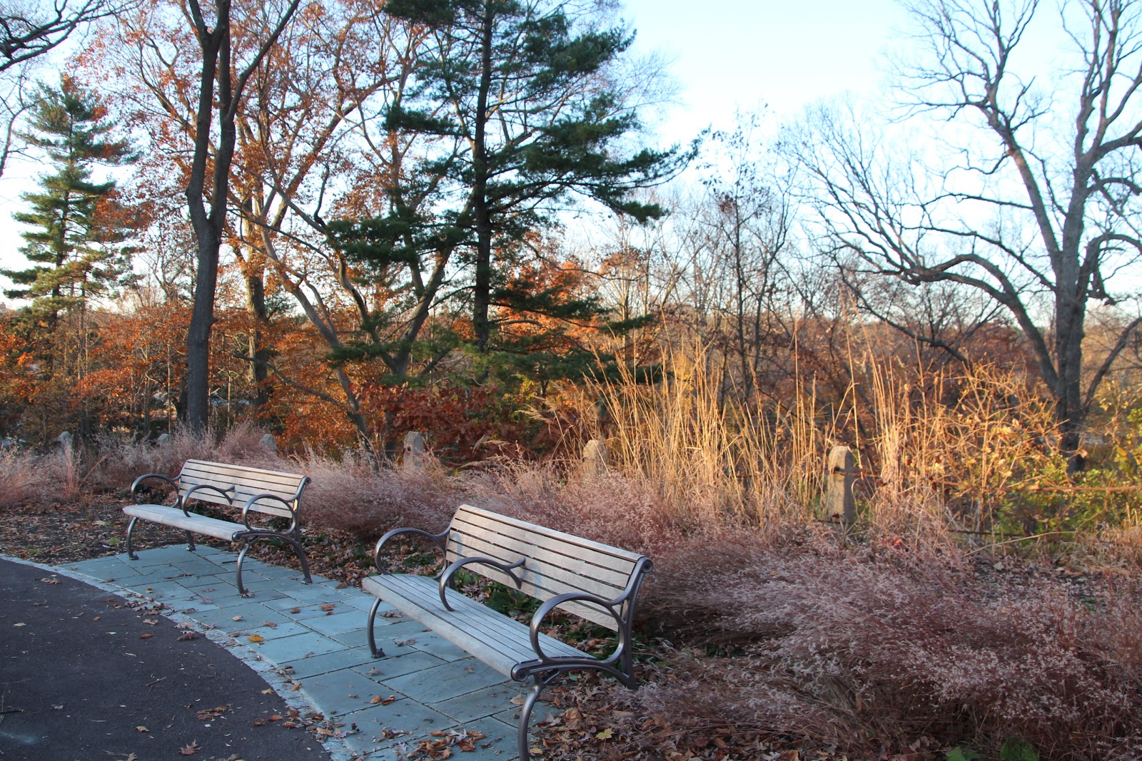
Another view of one of the landscaped sitting areas
Native little bluestem (Schizachyrium scoparium) used ornamentally
 In general, I think they got it mostly right.  The grassy path around the newly re-established grassland wends in and out of newly-planted edge habitat, and the landscaped garden areas are sensitively and attractively planted.  However, because of grant timing constraints, I believe that the municipality and the Friends took a shortcut which is going to--once again--doom the grassland.  The plan originally had called for the grassland to be seeded in the first year exclusively with native grasses.  Then, during the second year, wildflowers would be introduced by "plugs" and seeds.  The thinking was that, while the grasses were becoming established during the first year, the grassland could be sprayed with a broadleaf-killing herbicide that would keep weeds under control.  Then, with the grasses in place and the exotic weeds controlled or eliminated, the wildflowers could be introduced.  Instead, the grassland was seeded with a mixture of grasses and wildflower seeds because time was running out on the grant.  Now, the grassland cannot be sprayed with herbicide to control weeds because the herbicide will kill the wildflowers, too.  And, sure enough, there are already large patches of pernicious weeds present in the grassland.  The Friends intend to try to control these patches by hand or limited herbicide application, but I personally don't hold out much hope for overall success.
The grasslands delineated with attractive, low fencing.  The yellow trees in the background are all invasive non-native Norway maples (Acer platanoides)
Plantings of shrubs and small trees to expand the "edge" out into the grassland
During the field trip, one of the members of the Friends group approached me about serving on the Friends' board of directors.  I'm still giving it some consideration, but I don't have much spare time in my life.

Monday, November 26, 2012

A Black Friday Meant for Hiking, Not Shopping

Kali on the Northern Delaware Greenway paralleling Brandywine Creek
Neither Kali nor I had to work on the Friday after Thanksgiving, and the day was forecast to be gorgeous, with bright sunshine and temperatures approaching 60 degrees F.  A few weeks ago, I had read about Rocky Run, a tributary of Brandywine Creek and  "one of the highest quality streams in Delaware" in an issue of Backpacker magazine that a friend shared with me.  Since Delaware's Brandywine Creek State Park is only about an hour southwest of home, we had the prospect of a perfect day, we could explore a new venue, and a high-quality stream beckoned, how could we resist?

The Brandywine Creek rises in the far western Philadelphia suburbs and flows southward through a still-bucolic valley that was home to the Wyeth family of artists and to many of the very wealthy duPonts, many of whose estates remain intact.  Therefore, while the suburbs and the exurbs press in from the east, the Brandywine Creek valley acts like a green dam, holding development at bay.  Of course, the valley has long been used for industrial and agricultural pursuits, so it's far from pristine, but much of it is lovely.

Delaware's Brandywine Creek State Park, just south of the Pennsylvania border, was developed from a dairy farm formerly owned by the duPonts.  The park was subsequently enlarged through land donations by the Woodlawn Trustees, a foundation that permanently set aside open space in 1901 (1901!) thanks to the beneficence of its founder, a wealthy cotton tycoon.  The Woodlawn lands are also open to the public and are laced with pedestrian and equestrian trails.
 
Massive Asian bittersweet vines (Celastrus orbiculatus) on a woodland edge
Like almost all public land set aide for open space, and especially public land overseen by financially beleaguered state park systems, the land is not in good shape.  Much of the park had been used for agriculture, and the abandoned fields have become overgrown, weedy meadows full of invasive plants.  The stately woodlands on the steep slopes above Brandywine Creek are beautiful, but devoid of virtually any understory or advanced forest regeneration (i.e., young trees), probably because of white-tailed deer.  In fact, the only shrubs present in the woods are dense thickets of highly invasive shrub honeysuckles (Lonicera spp.) - very prominent this time of year because they hold their leaves longer than native shrubs.

Nevertheless, the day was perfect, and the woods were beautiful.  We started our walk up the valley of Rocky Run, the stream that had drawn us here in the first place.  The creek may be of high quality, but its valley was nothing special - a typical rocky Piedmont upland stream.  The path traced a line a few dozen feet parallel to, and a bit uphill from, the stream proper, so we actually only got occasional glimpses of the water.  After a mile or so, the trail crossed the creek, affording us some views. 

Trunks, roots and boulders on the Rocky Run streambank
Rocky Run viewed upstream at the trail crossing
The woods uphill of Rocky Run
An oak engulfing a gneiss boulder
American beech (Fagus grandifolia) leaves shot through with sunlight
Although the mature woods in the park are on very steep slopes above Rocky Run and Brandywine Creek, and they are extremely rocky, they must have been used agriculturally because stone walls thread throughout.  Perhaps they were used for pasture, not for cropping.

A casual stone wall in the woods
Gneissic bedrock and Christmas fern
Botanic love that dare not speak its name - intimacy between a tuliptree (Liriodendron tulipifera) and an American beech (Fagus grandifolia)
After Kali and I completed a circuit in the wilder, less developed part of the park, we crossed Brandywine Creek onto the portion of the park that had been a duPont dairy farm.  The power of wealth was evident in the stone walls, which were no longer composed of boulders piled in rows as they had been in the woods on the opposite side of the creek. Here, the walls were carefully constructed affairs, with the stones squared off and fitted tightly together befitting an estate.

A stone wall on the former duPont dairy farm
Incidentally, the stone used to build the walls is known locally as bluestone because newly broken stone faces have a distinct blue-gray cast.  The stone is actually a dense metamorphic gneiss characteristics of the northern Piedmont uplands.  The stone has lent its name liberally in northern Delaware; for example, the Wilmington baseball farm team is called the Blue Rocks.

Late in the afternoon, the blue skies disappeared as a cold front approached, accompanied by clouds and significantly cooler temperatures.  The weather was telling us it was time to leave.  We couldn't have asked for a nicer day.

Kali crossing a trail bridge over a small Brandywine Creek tributary on the way back to the car

Sunday, November 25, 2012

Fire and Ice


The morning after Thanksgiving broke frosty and densely foggy.  As soon as I got out of bed and recognized the photographic potential of the morning, I hurriedly dressed and ventured out into the grasslands to capture the incandescent dawn. 

Saturday, November 24, 2012

Thanksgiving


On Wednesday, the eve of Thanksgiving, I had to work, but Kali was off.  Traditionally, we close the office of the preserve an hour early on the eve of holidays, so I took full advantage of the opportunity to leave while the sun was still shining, and I hustled Kali out the door for a walk before sunset.  Because we only had time for a short walk, I didn't take the camera with me - big mistake!  After all, what does it take to sling the camera over my shoulder?  The late afternoon light turned out to be perfect for photography, even on our short walk, and I could have kicked myself.

Fortunately, Thanksgiving day was forecast to be a meteorological repeat, so we set off again on Thursday at about the same time of day, which allowed me to capture the preserve in the way I had been unable to do the day before.

Upon entering the grasslands, we came across a doe half-hidden in the grass.  She had been at exactly the same spot the day before.


But this handsome buck, which had not been present one day earlier, was browsing at the edge of the woods.


The dried seed heads of staghorn sumac (Rhus typhina) made a stark contrast against the cobalt blue sky.


Late afternoon light bathed a sycamore in a grassy draw.


The low sun burnished the grasslands...


....and the massive ancient red oak tree (Quercus rubra) capping a hill.


But the turkey in the oven was nearing the end of its roasting time, so we cut the walk short and headed back across the already darkening fields.

Thursday, November 22, 2012

One Trail Twelve Times - November


Asian bittersweet's (Celastrus orbiculatus) irresistible yellow carpels and red fruits tempt wreath makers, who then discard their handiwork after the holidays, thus helping to spread this menace.
Five walkers joined me for the penultimate installment of One Trail Twelve Times on Sunday afternoon, November 18, under partly sunny skies with temperatures in the upper 50s.  At first, I thought that we might complete the circuit of the Beech Springs Trail in record time because the somber, dun-colored fields seemed to offer little to observe.  But, in the end, we actually returned a bit later than usual; there's always plenty to enjoy.

When we entered the woods and immediately came upon a red oak (Quercus rubra) brought down across the trail by Hurricane Sandy.  Though the staff had cleared the canopy of the oak out of the path, the limbs, branches and trunk remained.


The downed red oak trunk sprawled across the forest floor
Red oak - dismembered
At the woods-meadow edge, the white pine saplings were damaged by bucks rubbing their stems and eating their tender tops.  Must give them piney fresh breath!
Emerging from the woods into the upper fields.  The buildings in the distance are a barn complex built in the 1920s when the fields were used for grazing cattle.  Today, the buildings have been renovated for use as the maintenance and office complex of a church.
Goldenrod (Solidago spp.) in seed
Indian-hemp (Apocynum cannabinum) seeds
Horse-nettle (Solanum carolinense), a weedy, prickly native member of the tomato family

When we left the wet meadows, crossing the Eagle Scout footbridge across the gully, I looked downstream.  Normally, the sight line is limited by a tangle of nearly impenetrable vegetation, but with the onset of autumn many of the plants had lost their leaves, revealing a pool and high, rocky banks adorned with Christmas ferns (Polystichum acrostichoides).

American Hornbeam (or Musclewood, or Blue-beech, or Ironwood) (Carpinus carolinense)  helping to stabilize the gully's bank.
A fallen tree spanning one of the Beech Spring runs.  I've included an image of this tree in each post as a marker and reference for the walk.  The spring run was completely dry on the surface; we've had almost no rain since Hurricane Sandy, and even Sandy's contribution was modest.
November in the beech woods

With the leaves gone from the native spicebush (Lindera benzoin) shrub layer, it has become obvious that the shrub layer is not all spicebush but also includes a healthy population of invasive, non-native jetbead (Rhodotypos scandense )that, like many non-native plants, holds its leaves longer than the natives.  Such a strategy gives the invasives a competitive advantage over the natives because they can photosynthesize longer than the natives. 


As the group rounded a corner in the trail, we came across a large white oak (Quercus alba) uprooted by Hurricane Sandy.  If you look closely at the left side of the image, you'll see that that the oak toppled into a neighboring tree, uprooting that tree as well like two tumbling dominoes.
A hard, dessicated, mahogany-colored fungus at the base of an oak tree
Termite-riddled base of the Pileated Woodpecker Tree
Around the next bend in the trail, we came upon another sad casualty of Hurricane Sandy--the Pileated Woodpecker Tree. This bird cherry (Prunus avium) snag bore an unmistakable rectangular  hole excavated by a Pileated Woodpecker and was a landmark along the walk.  Bird cherry wood is not strong in the first place, and the insect damage at its base had clearly weakened the tree enough to topple it during the hurricane.  The fallen trunk had blocked the trail, so my staff had cut it into manageable sections to clear the path.

Pileated Woodpecker Tree
On close inspection, we discovered that fungi had colonized the tree, and had begun to emerge through cracks in the bark - like fiery lava oozing out of the earth!
Blackberry (Rubus sp.) in regal purple
Kali helping to disperse milkweed seeds.  This is among her favorite autumn activities, and helps to perpetuate milkweeds - and Monarchs!
Silvery samaras of a box-elder (Acer negundo) at the head of the gully
Botanizing at the edge of the meadow

The final leg of the trail passes along the center of a long double allee of white pines (Pinus strobus) planted in the 1920s.  Two of these pines lost major limbs during Hurricane Sandy, both of which came down across telephone and cable lines.  The telecommunication lines never snapped, but the limbs bowed them down to the ground.  These were among the last tree (parts) cleared off utility lines in our area because, unlike electricity, they were not essential and because the serve had not been interrupted.

One of the damaged white pines
Final vista across the late autumn fields
Because the end of this series of rambles is imminent, the "regulars" began to hector me about choosing another trail for the next year and repeating this program.  I'm reluctant to commit to one weekend afternoon a month again (though, in all honesty, it hasn't been onerous or interfered much with my life, and I've really enjoyed the walks and camaraderie).  I've discussed this with Kali, but haven't made a decision yet.  I'm thinking of doing one walk a month on a different trail each month until we complete a walk on every trail in the preserve.