Showing posts with label wetland restoration. Show all posts

Wednesday, October 7, 2015

Thousand Acre Marsh, Delaware


View north across the marsh.  Bridge at far right bears Del. Rte. 9 over the C&D Canal
I attended the Third Annual Delaware River Watershed Forum at the University of Delaware in Newark, Delaware over the last two days.  The first day's activities included a field trip to one of five sites along the Delaware Estuary to see conservation and restoration projects. I chose to visit Thousand Acre Marsh.  This extensive freshwater wetland is a well-known birding destination that is at risk for a wide range of impacts due to sea level rise.

The marsh is a freshwater impoundment located in the southwest corner of the intersection of the Chesapeake & Delaware Canal and the Delaware Bay.  The northern levee of the marsh (along the canal) was created when the C&D Canal was dug, and the eastern levee (along Delaware Bay) was created to protect the right-of-way of Delaware Route 9, which hugs the bay shore. 
A ship eastbound from the Chesapeake to the Delaware Bay in the C&D Canal
Representatives from the Delaware Department of Natural Resources and Environmental Control informed our group about the efforts of a multi-agency partnership to expand habitat and bolster ecotourism while addressing the failing bay shore levee and combating the expansion of invasive phragmites reeds. 
Tour group at the water level control structure on the failing bay shore levee
Best feature of the tour:  I added a new bird to my life list, a Little Blue Heron!  In addition, there were more Bald Eagles flying here than I have seen anywhere else except in Alaska; most were immature.

Salem Nuclear Power Plant in Salem, NJ directly across Delaware Bay

Wednesday, April 1, 2015

Field Trip Sampler


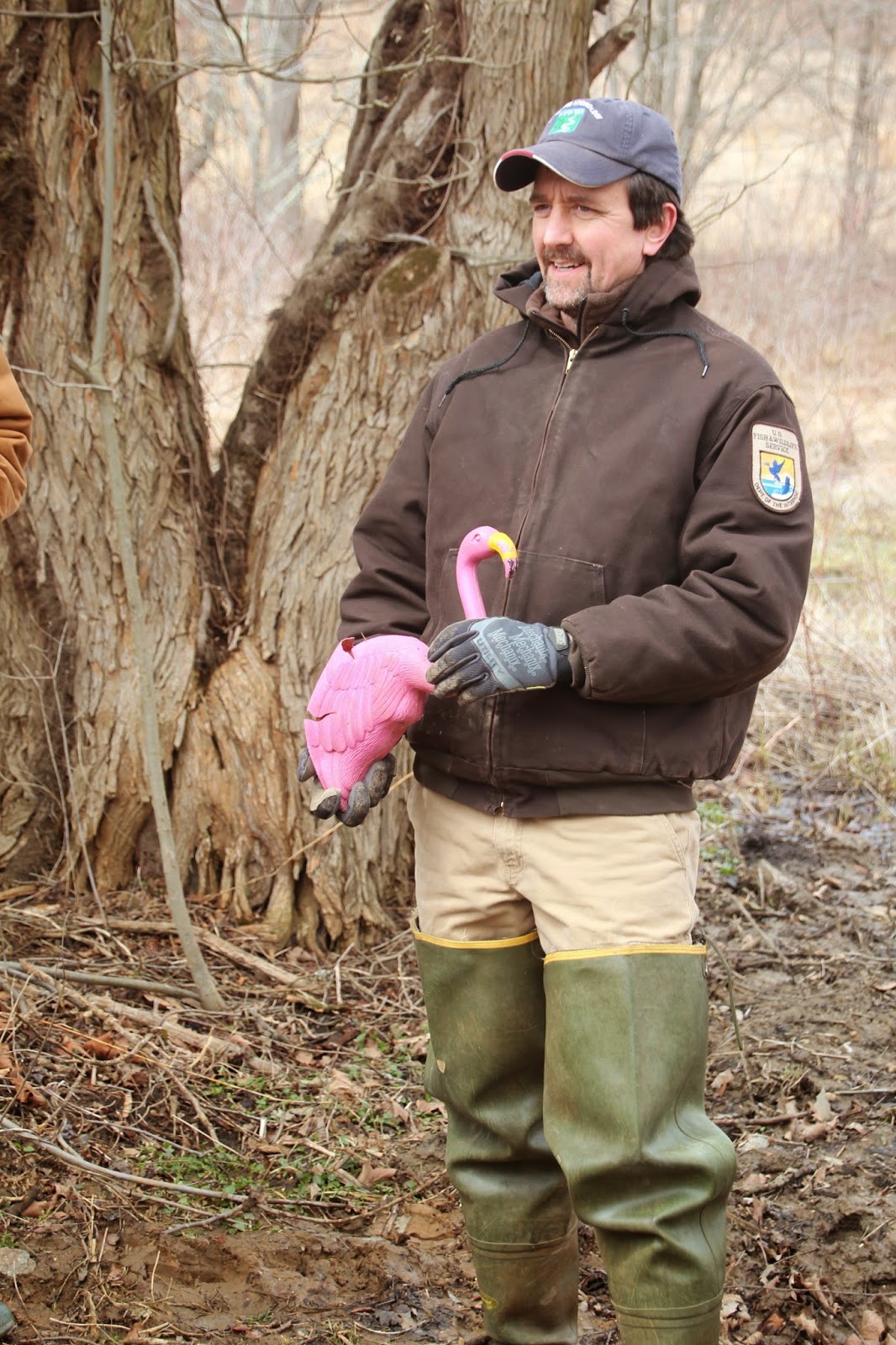
U.S. Fish and Wildlife biologist with a rare bird
Last weekend (March 26-28), I attended the Society for Ecological Restoration Mid-Atlantic Chapter's 10th Annual Conference at the University of Delaware in Newark, Delaware.  (For those not "in the know," never pronounce Newark, Delaware like Newark, New Jersey.  The New Jersey city is pronounced NEW-erk, whereas the Delaware city is pronounced new-WARK.)  Following a Thursday evening dinner at which I and eight colleagues were feted as founders of the chapter, the group re-convened the following morning for a day of formal presentations.  On Saturday, I participated in a field trip of three restoration sites within a half-hour's drive of the university.

Saturday was mostly cloudy, cold (high of 40 degrees F in the afternoon) and windy.  As we waited for the bus to depart, the group endured snow squalls.

Northern Delaware is DuPont territory.  Many of the wealthy heirs of the DuPont chemical fortune established expansive estates in the rolling hills of Delaware's Piedmont west of Wilmington, and some of these were sites we visited.  Our first stop was Mt. Cuba, a 500-acre estate that has been turned into a botanic garden featuring plants native to the Piedmont.  The 50 acres surrounding the mansion are a horticultural showplace and are beautifully maintained, but the remainder of the property (the part our group visited) faces the same challenges I face at my preserve: overabundant deer, invasive plants, and stream flooding. 
Nathan Shampine, Mt. Cuba's natural lands manager, indicating that deer could gain access to this fenced exclosure
The golden rolling hills of northern Delaware's Piedmont in early spring
A Red-winged Blackbird's epaulet (Agelaius phoeniceus) found on the ground

Our second stop was the Delaware Nature Society's Coverdale Farm and Burrow's Run preserves.  At Coverdale Farm, we explored a wetland restoration project in which a wet cattle pasture formerly drained by terracotta tile pipes had been reflooded (by removing and breaking the pipes) in order to provide habitat for federally endangered bog turtles (Clemmys muhlenbergii).
The wetland created by re-flooding the field--a sedge hammock marsh
The re-engineered outlet from the marsh (still a bit raw)

Our group continued walking to the adjacent Burrow's Run Preserve, where the Delaware Nature Society has been converting pastures to native grasslands for grassland-nesting birds.  I literally was in awe and very jealous of their best fields, pictured below.  These fields support moderate growth of little bluestem grass (Schizachyrium scoparium) interspersed with dozens of species of forbs (i.e., wildflowers) - exactly the type of habitat meadow-nesting birds are seeking.  The grasses provide cover and the forbs attract insects for the birds to eat.  The fields at my preserve, in contract, are almost exclusively grassy with few forbs, which is why we haven't had luck attracting birds to my fields.
Beautiful native meadows
Queen Anne's Lace (not native) against gray skies
Our last stop was the Flintwoods Preserve, a 157-acre private (DuPont heir) estate whose claim to fame is a stand of ancient forest.  Our group, however, toured the native grassland restoration projects underway in the old agricultural fields on the property.

A renovated barn on the Flintwoods estate
We parked our bus next to a renovated barn on the estate.  The barn is full of vintage baroque harpsichords that Peter Flint is in the process of restoring.  The Flints host sold-out baroque music concerts in the barn several times each year.

Flintwoods' land manager explaining how he intends to modify his management plan for his grasslands this year
A humorous aside: as we were returning to the university following the field trip, driving through the northern Delaware countryside sprinkled with DuPont properties, one of the fellows on the bus quipped, "I keep looking at all these houses and imagining sexually-charged wrestling matches going on in each one." (a reference to last year's film Foxcatcher).  Of course, after he said that, I couldn't look at the places the same way myself! 

Friday, July 18, 2014

At the Headwaters


At the headwaters of my creek
My preserve is located in the center of the watershed drained by the creek flowing through the preserve.  Downstream of my preserve, the creek's floodplain and some of the adjacent steep slopes are pretty well protected in county and city parks.  But upstream of my preserve, the watershed has largely been built out in typical suburban style.

As a result, the biggest environmental problems with my creek are related to stormwater runoff from the impervious surfaces upstream of my preserve.  Stormwater generates problems like erosion, sedimentation, turbidity, flooding, and low stream baseflow between storms (because precipitation runs off impervious surfaces and does not have a chance to filter into the ground to recharge springs).

One of the largest Philadelphia-area philanthropic foundations recognizes these problems in my and my neighboring suburbanized watersheds, and the foundation has begun a multiyear, $37 million initiative to begin to address these problems.  On Tuesday, I learned that our organization had been awarded a $165,000 grant to create a stormwater detention wetland at the very headwaters of my creek.  The wetland basin will intercept the runoff from a 40-acre housing subdivision, infiltrate part of the water, and trap sediments, thereby improving water quality in the creek (we hope). 
Project manager (center) pointing out details of the project
Though my organization was awarded the grant, we will be building the wetland project on another non-profit's property: a summer camp for economically disadvantaged children.  The camp, which has a strong environmental education component, will use the wetland to teach children about the importance of stormwater management.  At 235 acres, the camp is the largest natural area upstream of my preserve, and it's located right at the headwaters of my creek.
A representative of the foundation (in pink, on right) explaining  the foundation's goals
On Wednesday, July 16, project engineers, university scientists, and a representative of the philanthropic foundation that is paying for the project visited the site - currently a wet swale in a meadow.  We'll be starting work on the project in the next few weeks.

I'm not overly excited by this project because (1) it's not in my preserve (where there's already plenty to do), (2) it's not going to make much of a difference in terms of water quality in a 56-square-mile watershed, and (3) there's almost no money in the tight budget for project administration.  However, it gives our organization good "press," receiving the grant makes me look good to my board of directors, and the project is a step in the right direction for the watershed, so I'll take it.
Departing the site.  There are worse places for a walk on a sunny summer afternoon.

Tuesday, April 15, 2014

Disappointing Friday Field Trip


Male red-winged blackbird (Agelaius phoeniceus) in full mating display
Last Friday (April 11) I escorted my graduate landscape restoration students on a field trip to a site I had previously visited but had never used for a class field trip - and was disappointed.  The site was on the expansive campus of an exclusive and very expensive private school.  The campus straddles a large, flood-prone creek.  Years ago, probably before the creek's upper watershed became so heavily suburbanized and covered with impermeable surfaces, the school had built its athletic fields on the creek's flat floodplain. 

But, as the creek began to flood with increasingly frequency, the fields could be used less and less often.  The school finally decided to undertake major capital improvements.  It moved the fields out of the floodplain and replaced the fields with a series of interconnected basins that gather stormwater and hold it until the creek's level falls low enough to accommodate the runoff.  In addition, the basins were naturalized with native plants to create wildlife habitat. 

The school spared no expense in this project (both to build its new first-class athletic fields and to restore the floodplain), so I guess that's why the results were all the more disappointing.    
Parking lot "rain gardens"
Our tour began at the athletic fields parking lot, where runoff from the paved surfaces is channeled to rain gardens where it filters into the soil or, if the soil's infiltration capacity is overwhelmed, is shunted to a detention basin.  Unfortunately, the "rain gardens" consist of thick layers of mulch and a very few forlorn shrubs. 
Up against the wall, rain garden
Next we visited a rain garden adjacent to a retaining wall holding up the football playing field.  Our guide (a faculty member among whose other responsibilities at the school is to manage the new restoration area) explained that the construction activity had left the area completely barren and full of clayey, compacted soil.  So, to create the rain garden, the contractor had excavated five feet of poor soil and replaced it with layers of stone, gravel, and sandy loam to improve infiltration.  Then, the contractor planted shrubs and trees.  Unfortunately, it appeared to my students and me that the rain garden, which should have looked like a shallow depression, was actually slightly mounded above the rest of the landscape.  So much for collecting much runoff.
Overlooking the basins on the floodplain
We finally got to the floodplain, where the athletic fields had been replaced by the interconnected wetland basins.  Our host explained that cattails (Typha spp.), a native but aggressive species, quickly colonized the basins after construction and had completely taken over the shallow wetlands, providing a bit of wetland habitat, but not diverse, high quality habitat.  Our host explained how the students' parents did not want the school to use herbicides to control the cattails, and that she had instead organized volunteer work parties to uproot the cattails.  For a few years, the work parties could keep ahead of the advancing plants, but then the novelty of the project wore off and the volunteers disappeared, hence the rank growth.  In addition, the dreaded and highly invasive Phragmites australis reed had begun to appear in the ponds, too.
Re-excavated wetland basin
Our last stop was a wetland basin that the school uses as for water quality studies.  This basin, like the others, had become overwhelmed by cattails, but the school needed to maintain open water so that the students could conduct water quality monitoring.  Over the winter, the school hired a contractor to excavate the basin and remove the accumulated organic matter and the cattails and reeds.  How long until the cattails reappear (and the contractor returns)?

Because we had a little time before the class was over, we walked up a small drainage to a spring seep on a hillside.  Here, in the wet area below the spring, skunk cabbage had begun to emerge from its winter dormancy.
Skunk cabbage (Symplocarpus foetidus) in a spring seep
Eastern garter snake (Thamnopnis sirtalis sirtalis) on the floodplain among the invasive non-native lesser celandine (Ranunculus divaricata)
I have to ask the students this Friday if they felt that the field trip was worthwhile.

Friday, February 22, 2013

A Drop in the Bucket...but It's a Start


Common cat-tails (Typha latifolia) in the winter marsh
I'm teaching as an adjunct at Temple University this term.  My course is undergraduate Landscape Restoration, and the class took a field trip to a wetland restoration site yesterday afternoon.

Bob Adams, Director Stewardship at the Wissahickon Valley Watershed Association, explaining the project to the students
The area where the wetland was restored had been a municipal softball field, but it was located in the floodplain of Sandy Run, an extraordinarily flood-prone tributary of the Wissahickon Creek.  Bob Adams, our guide and the Director of Stewardship at the Wissahickon Valley Watershed Association who designed and oversaw the construction of the wetland, explained that the softball field was hardly ever used because of wet soil or standing water.  So, the watershed association applied for state funding to restore the site.

Two years and $100,000 later, the 2-acre wetland was completed.  There are still problems with invasive species - especially purple loosestrife (Lythrum salicaria) - but the weevils that have been imported as biocontrols from the plant's native range in Europe seem to be reducing the vigor of the infestation.

Bob Adams showing the students a piezometer used to gauge the groundwater level
Planted trees protected from deer browsing by wire cages
We also walked to the banks of Sandy Run to look over the stream and review the challenges of trying to restore a riparian area near a stream that is so temperamental.

A tree cage damaged by flooding on the bank of Sandy Run
At the conclusion of the tour, the students left the site, but I stayed behind to capture a few more images.

The marsh in winter, partially ice-bound
Last summer's nest, probably built by an American robin (Turdus migratorius)
No one could identify this plant, but I liked its winter profile
Pussy willow (Salix discolor) wands
Silky pussy willow ovaries
Except for the electrical lines, this could be wilderness.  Actually, the site is embedded in the middle of the 'burbs.
This two-acre site represents an infinitesimally small part of Sandy Run's watershed, so the wetland can't possibly have much of an impact on the quality or quantity of water that roars through the valley after a heavy rain.  But, it broadens the riparian area, and it provides habitat for quite a few wetland-dependent species despite its proximity to a busy suburban thoroughfare.