Showing posts with label San Diego. Show all posts

Tuesday, January 10, 2012

Heller's Bend

 A gall on a California live oak in Heller's Bend Preserve
Following up on my previous post...

The second day I visited with my ailing father in northern San Diego County, we repeated a morning stroll along the San Luis Rey River Trail, then he snoozed in the afternoon.  I took the opportunity to visit the Fallbrook Land Conservancy's 50-acre Heller's Bend Preserve.
Ferns sprouting from a horizontally rent granite boulder
None of the few walkers I encountered at the preserve knew its history, but it seemed to me that the land had been a private estate on which a house had never been built or on which a house had been demolished.  The preserve entrance is located in the floodplain of Tamarack Creek, a perennial rarity in arid southern California.  The paved entrance drive crosses the creek, then ascends steeply several hundred feet to a bench of land that provides fine views eastward over the suburban development of Fallbrook to the mountains beyond.
Much of the land in the preserve looks like it needs to be rehabilitated--that it had been damaged by human manipulation as it was forced to be an estate showplace but had been neglected and was trying to recover.  There were numerous dead and dying trees, and groves of ornamental shrubs peppered the landscape.
Along Tamarack Creek

Root of California sycamore along the bank of Tamarack Creek

Monday, January 9, 2012

Montserate Mountain

The trail to the top of Montserate Mountain
From Wednesday to Saturday last week (January 4-7, 2012), I was in San Diego visiting my father, who is dying of congestive heart failure.  My stepmother told me that my father's condition improved markedly when she told him that I was coming to visit, and we had a great few days together.  On both Thursday and Friday mornings, I pushed him in his wheelchair for 5 miles along the sunny, breezy San Luis Rey River Trail in Oceanside, California, where we enjoyed watching birds in the riparian trees and other people using the popular trail.

The walks left him tired in the afternoon (even though I was doing all the work). So, on Thursday afternoon, while he napped, I explored the Fallbrook Land Conservancy's Montserate Mountain Preserve.  The trail to the top of 1,269-foot Montserate Mountain is a 1,200-foot climb over a distance of a little less than two miles, so this flat lander had to rest frequently on the ascent.
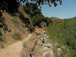
Along the trail to the top of Montserate Mountain.
Boulders along the trail; the saddle between the two crests is in the upper left.
The image above is a view to the northwest.  The terraced hills visible in the midground are used for avocado orchards (Fallbrook is the avocado capital of the United States), but they are quickly being converted to residential subdivisions because Fallbrook is a high-end community with a lot of development pressure.  The mountains on the horizon are the Santa Ana Mountains just outside Los Angeles.

Flowers along the trail.  Because it's winter, there weren't many flowers blooming.  I can't identify the blue flower, but I believe the orange flower is called Mexican honeysuckle.
The cairn on the crest of Montserate Mountain. This view is eastward.  The mountains in the distance are the Aqua Tibia Mountains, which are protected in the Aqua Tibia Wilderness.  The Aqua Tibia range is a northwestward extension of Palomar Mountain, the site of a famous astronomical observatory.

Although I didn't notice any insects on my way to the top of the mountain, at the crest I was greeted by a fluttering aggregation of about three dozen butterflies.  Strange and unexpected.
The moon rose while I caught my breath and enjoyed the scenery at the top.

Tuesday, July 20, 2010

California, Naturally

Detail of tree bark, Santa Margarita River Trail, Fallbrook Conservancy, CA

Several of my wife's and my family members live in San Diego County now, so I'm on the West Coast about once a year. Since we had been in southern Utah in May--two-thirds of the way to San Diego--we hopped a flight from Salt Lake City to San Diego for six days. Most of the time we visited with family, but we took two "natural" excursions to places we hadn't visited before, the tide pool at Point Loma on the ocean side of San Diego Bay and the Fallbrook Conservancy's Santa Margarita Preserve at the far northern edge of San Diego County, hard by Orange County.

Cockle shells in the tide pools

We arrived at the tide pools at Point Loma at the maximum low tide, so we only had about 45 minutes to poke around in the pools before they were flooded again. There were lots and lots of anemones and hermit crabs to enjoy.

Yours truly (with splayed legs) observing up close

My brother-in-law (left) and I looking for crabs hiding in niches in the sedimentary cliff

Who's watching whom?

On our last day in California, my dad suggested that we go for a walk at the Fallbrook Conservancy's Santa Margarita River Preserve. The "river" (we East Coasters would have a hard time calling it even a creek, but it is a perennial stream and offers important riparian habitat) rises in the Cleveland National Forest in San Bernadino County, skirts the northern edge of San Diego County, and then enters Camp Pendleton Marine Corps Base before draining into the Pacific Ocean. It's a popular outdoor playground for rapidly developing northern San Diego County and southern Orange County. The day was hot, it was a Saturday, and quite a few folks took advantage of the river to cool off.

Santa Margarita River, Fallbrook Conservancy, Fallbrook, CA (I didn't notice my brother's arm pointing out a fish in the river until I posted this image.)

Santa Margarita River Trail, Fallbrook Conservancy

Santa Margarita River, Fallbrook Conservancy, CA
Swimming optional

Oak clinging to the cliff for dear life

Along the Santa Margarita River Trail. A cannonball?

Wednesday, June 16, 2010

Lizards

Gecko on a tree at the San Diego Wild Animal Park
Both the gecko and the tree were probably not native to southern California, but I liked the image.

I'm finally getting a chance to review (and edit) the 1,200+ images from our late-May trip to southern Utah and San Diego. Here's an assortment of the best of the lizard images from the trip. I don't know the identities of any of the lizards.

Along the Hickman (Natural) Bridge Trail, Capitol Reef National Park, Utah

In Spring Canyon, along the Chimney Rock Trail, Capitol Reef National Park, Utah

Along the Fremont River Trail, Capitol Reef National Park, Utah

Along the Fremont River Trail, Capitol Reef National Park, Utah
Enlarge the image to see the lizard's striking blue armpit

Wednesday, March 25, 2009

San Diego, Part 6 (final) (San Elijo Lagoon)

An attractive but exotic species of mustard at San Elijo Lagoon Ecological Reserve.

On our last full day in San Diego (March 13), my wife and I left my father's place in North County after breakfast and drove back to the city to stay with my brother-in-law. We were leaving on a very early flight the next morning, and my brother-in-law's place is a half-hour closer to the airport than my dad's. Although we got to my brother-in-law's place at 11 a.m., we really didn't have anything planned for the day, which put me in a bad mood; for me it's all about "structure." Eventually, we decided to walk the beach at Torrey Pines State Park near La Jolla, and off we went.


En route, we stopped at Los Penasquitos Estuary, just short of the beach, because I noticed large numbers of shorebirds and waterfowl. We birded the mudflats and pools for about an hour, and then my brother-in-law said, "I know a great birdwatching site just up the coast!" and off we drove to San Elijo Lagoon Ecological Reserve in Solana Beach, where we birded for the rest of the day. We never made it to the beach.

San Elijo is mostly salt marsh habitat, but there are small sections of coastal scrub, freshwater marsh, and grassy uplands as well. The diversity of habitats was great for us because we were able to see 28 species in the space of a few hours, and we were able to add several species to our life lists:
  • Marbled Godwit (Limosa fedoa)
  • American Wigeon (Anas americana)
  • Gadwall (Anas strepera)
  • American Avocet (Aythya americana)
  • Costa's Hummingbird (Calypte costae)
  • Savannah Sparrow (Belding's race) (Passerculus sandwichensis)
  • Lark Sparrow (Chondestes grammacus)
The western trailhead at San Elijo Lagoon Ecological Reserve. There's a hot air balloon in the background.

After we left San Elijo, we drove out to Poway (a northeastern suburb) for some mediocre live music and pub grub at a faux British bar called Phileas Fogg's.

Here endeth my account of my 2009 spring break in San Diego.

Tuesday, March 24, 2009

San Diego, Part 5 (Getty Center in Los Angeles)

On Thursday, March 12, my father, my wife and I drove north to enjoy the J. Paul Getty Museum in Brentwood northwest of Los Angeles. The museum's permanent collection includes pre-20th-century European paintings, drawing, illuminated manuscripts, sculpture, and decorative arts, including three Rembrandt and Van Gogh's Irises.

The drive north from northern San Diego County was hectic, especially from Long Beach northward. Fortunately, because we had three passengers in our car, we could use the HOV lane most of the way, but even the HOV lane clotted as we approached downtown Los Angeles. We arrived at the museum after 2-1/2 hours.

Visitors park in a 7-story underground garage at the entrance to the complex, then board a tram that ferries them 900 feet to the top of the Santa Monica Mountains and the gleaming Getty Center.

The museum and associated research institute are located on a 24-acre campus surrounded by 600 acres kept in their natural state. From the balustrades at the museum, we could see the Los Angeles skyline, the San Bernadino Mountains, and the Pacific Ocean.

The stunning complex was designed by Richard Meier, who took full advantage of the site's two diverging ridges. One ridge contains the four gallery buildings, and the other ridge contains the administrative and research buildings. The buildings themselves are constructed of concrete and steel clad with travertine and white aluminum. Numerous fountains are scattered throughout the campus, and extraordinarily rigid formal gardens anchor the southern part of the complex. These gardens should have appealed to my extreme anal-retentive side, but they were just too formal, even for me.

We arrived just in time for an 11 a.m. guided "highlights" tour of some of the museum's best pieces of furniture, sculpture, and paintings. Then we had lunch on one of the terraces--sitting in the sunshine to maintain our warmth in the chilly breeze. After eating, we ventured back into some of the galleries to enjoy the Impressionist and Renaissance paintings. By 3:30, we had all experienced "museum fatigue" and got ready to return to San Diego.

I was bowled over by the architecture at the Getty Center, and we certainly enjoyed the museum's collections but, frankly, after visiting St. Petersburg, Russia, two years ago, it's hard to top the largest collection of artwork in the world housed at the Hermitage.

Photography is permitted inside the Getty, but I only made one image: a Meissen porcelain turkey. I collect turkey figurines (and own a tiny Meissen turkey), but this piece was nearly the size of a full-grown turkey. It, and an accompanying animal figure, were designed to be the largest porcelain figures ever created up to that point in ceramic history, and both were complete failures--shot through with cracks and crevices. As a result, they were never glazed. Technology had not progressed to the point that the master ceramicists at Meissen could produce figures of this size.
Our trip back to San Diego County also took 2-1/2 hours, with heavy traffic in the same spots we encountered it in the morning.

Friday, March 20, 2009

(En route to) San Diego

I should have begun my "San Diego" series with this, since I've been keeping my posts in chronological order. Better late than never, though.

As passengers filled the plane in preparation for leaving my home airport, a young couple sat down in the two seats ahead of my wife and me. They were both in their late 20s or early 30s, slim, trim and attractive. Both were dark-haired and stylishly attired. As I undressed the guy with my eyes, I imagined his physique to be like that of the guy pictured above--lithe, taut and bearing almost no body fat--my perfect man. Like the guy above, he also had short hair. The fellow was wearing a black, long-sleeved shirt and tan slacks with just enough of a subtle pattern in the fabric to make them interesting.

Two things struck me about this handsome fellow. First of all, an arabesque of dense tattoos extended from the cuff of his left sleeve onto the back of his left hand. The design was so complex and fine that I thought that perhaps it was a temporary henna tattoo painted on his skin with a small brush, but after several hours' examination, I decided the marks were permanent. Unusual and intriguing.

Secondly, this fellow had the most beautiful eyelashes that I can ever recall seeing. I was able to look forward through the space between the seats and enjoy his long, sensuous, sable-colored lashes during the entire trip.

San Diego, Part 4 (Mission San Juan Capistrano)

On Wednesday, March 11, my father and stepmother escorted my wife and me on trip up the coast to the mission at San Juan Capistrano (which is actually in Orange County, north of Camp Pendleton). Frankly, I'd never had much interest in the Spanish colonial missions in California, but I was anticipating seeing the cliff swallows that return to the mission each year in March. I got two surprises that day: the mission was far more interesting than I had originally anticipated, and the swallows had not yet returned (scheduled arrival: March 19).

The mission complex is huge and consists of a large, open central courtyard enclosed by adobe brick buildings. The sides of the brick buildings facing the inner courtyard are all colonnaded, so that the complex has the appearance of a cloister. The central courtyard, which must have been a dusty, dirty, and noisy compound full of industry and animals when the mission was active, has been transformed into a beautiful formal garden with fountains.
California poppies growing in the mission garden

Parts of the complex have been opened to the public to demonstrate the living quarters of the mission's clergy as well as the industrial (e.g., leather tanning, smelting, ironworking) and farming (e.g., viticulture and wine production, grain cultivation) activities that took place when the mission controlled 100,000 acres surrounding the center.

The mission complex also contains the oldest building in California: the adobe mission chapel. A huge stone church was subsequently built into the walls of the mission, but an earthquake in the early 1800's demolished the building during a morning mass, killing 40 congregants. The ruins of the church are a prominent feature of the historic complex.
Ruins of the stone church

After visiting the mission, we went across the street and had a wonderful late lunch/early dinner in the shady courtyard of the Cedar Creek Inn restaurant. Dad ordered a Reuben sandwich, and it was delivered by our server, Reuben.

We spent an hour or so walking around central San Juan Capistrano, where there was a farmers' market in progress featuring luscious locally-grown strawberries as well as unbelievably inexpensive cut flowers.

Thursday, March 19, 2009

San Diego, Part 3 (Anza-Borrego Redux)

Rumor had it that the Anza-Borrego desert was in bloom most dramatically at Ocotillo Flats, the huge outwash fan from Coyote Canyon at the northern end of Anza-Borrego Desert State Park. My father, stepmother, and brother (all of whom live in northern San Diego County), wanted to enjoy the show, so my wife and I decamped from her brother's house outside San Diego and moved to my father and stepmother's place in North County for a few days. We picked up my brother (who worked that morning [March 10]), then we drove back to Anza-Borrego in the afternoon for our second sojurn.

After we descended the steep, dramatic highway leading down into the desert, we reached the abomination of a town called Borrego Springs, and turned north out of town, driving through irrigated organge groves and out into broad Lower Coyote Canyon. The pavement ended and we began a long, slow drive on a rocky, uneven, and rutted sand and dirt road up through the canyon. The wildflowers were most impressive just after the pavement ended, but we pushed on to get away from the crowds and into the desert.
Aptly named, Ocotillo Flats is a broad outwash from Coyote Canyon and supports mostly ocotillos, many of which were in bloom. We traveled up the canyon and forded Coyote Creek twice, then parked my brother's SUV when the road got too bad to travel further. Then, we walked up the canyon to the third crossing of Coyote Creek where our way was blocked by very dense thickets of willow. Intrepid hikers had cut a path through the willows, and we could have crossed to the other side if we'd wanted to, but the water was deep enough that we would have gotten wet. So, we bushwacked up the canyon off trail and away from the road until we came to a side canyon's outwash that was full of blooming cacti and ocotillos. I made this image of a cactus garden there.

After we returned to the car and made out way out of the canyon, dusk was settling in. We drove out of the desert and then westward, back toward the coast. On our way back to my dad's house, we stopped at the Pala Indian Reservation and had dinner at the casino's buffet.

Wednesday, March 18, 2009

San Diego, Part 2 (San Diego Zoo)

On the second day of our week's stay in San Diego, we decided to visit the San Diego Zoo. It was my second visit (and my wife's third), but it's always a treat. I don't know a better zoo in the world.

Because we got a bit of a late start, we were only able to see about half the exhibits. In addition, we spent a lot of time looking at the birds, and the zoo has lots of them on display.

We witnessed two disturbing incidents during our visit. In one large enclosure for a troop of guenons (African monkeys of the genus Ceropithecus), a youngster was trapped between the display fencing and the concrete "rock" at the bottom of the enclosure. It was being harassed by an adult male, who repeatedly swiped at the youngster. The young guenon cowered to keep away from the taunting adult. The youngster's mother was clearly distressed, but kept her distance from the aggressive male. Finally, the zookeepers enticed the male away from the youngster with peanuts, and the mother quickly grabbed her youngster and cuddled it away from the adults.

The second incident didn't end as nicely. When we approached the peccaries' (Tayassu pecari) exclosure, a large group of people had gathered and were watching intently. Soon, we saw what had attracted their attention: one of the adult peccaries was tearing apart a newborn peccary that was still alive. The mother, trailing afterbirth, paid no attention to the carnage. After a few minutes, several other other peccaries joined the action, and the newborn was rent asunder. I have to say, they weren't very efficient. We wondered if this was a natural response to overcrowding and confinement.

We spent the end of the day at the two large aviaries where I caught these images.

I wish that I could say that I caught this Wood Duck image in the wild, but it was at the zoo.


Java Mynah

After the zoo, my brother-in-law, took us for coffee at Peet's Coffee in Hillcrest. We passed Mo's restaurant and bar on the way. My brother-in-law told us that it was a popular hangout for folks of all persuasions. It look like it was already swinging, even though it was just 6 p.m.

Tuesday, March 17, 2009

San Diego, Part 1 (Anza-Borrego Desert)

Hiking in Rainbow Canyon with my handsome brother-in-law.

My wife and I spent a week in San Diego and environs (March 7-March 14, 2009). My next youngest brother, my brother-in-law (about whom I have written before), and my father and stepmother all live in San Diego County, so there's no shortage of places for us to stay and visit. A pilgrimage to Anza-Borrego Desert State Park in the eastern part of the county is always among our highest priorities, and we visited twice during this trip, once on Sunday (March 8) with my brother-in-law and again on Tuesday (March10) with my brother, my father and my stepmother.

The desert reportedly was in riotous bloom this year (there was even a feature about it on NPR's All Things Considered), and I think that this week (March 15-21), it is probably is floriferous. But the week that we visited, many of the flowers were just beginning to emerge. Parts of the desert were spectacular, but according to veteran desert visitors, this year is good but not great. From someone coming from the East Coast, I had nothing to complain about.

We completed two short hikes on Sunday. First, we scrambled a mile up an area unofficially called Rainbow Canyon, so named because erosion has exposed bands of multicolored, tortured rocks. The plants growing in the alluvial outwash at the lower end of the canyon were blooming profusely, but within the tight confines of the canyon, only barrel cacti were in in bloom. There were lots of moderately difficult climbs up spilloffs and chutes, but we navigated them all successfully and had a great time. I also added two bird species to my life-list at Rainbow Canyon: Phainopepla (Phainopepla nitens), and Lawrence's Goldfinch (Carduelis lawrencei).

After we emerged from Rainbow Canyon, we traveled 20 miles south to Mountain Palm Springs. Here, we walked up a canyon that featured several stands of California fan palms growing in oases at the bottom of the canyon. My brother-in-law and I climbed another mile and a half up the canyon to see the elephant trees growing in a basin above the palms. I added another bird to my life-list here: a White-winged Dove (Zenaida asiatica).

It was a great day. In fact, any day in Anza-Borrego is a great day as far as I'm concerned.

View of Anza-Borrego (and my brother-in-law's nice butt) from Elephant Tree Basin