Monday, July 12, 2010

Slickrock Divide and the Goosenecks, Capitol Reef

The Goosenecks meanders of Sulfur Creek

On the way out of Capitol Reef National Park following our day-trip through Capitol Gorge, I stopped to take some pictures at the Slickrock Divide, a minor watershed divide within the park.

Descending from the Slickrock Divide summit

The snowcapped Henry Mountains, a volcanic pile, are in the distance. I'd never heard of the Henrys before this trip, and now I want to explore there, too!
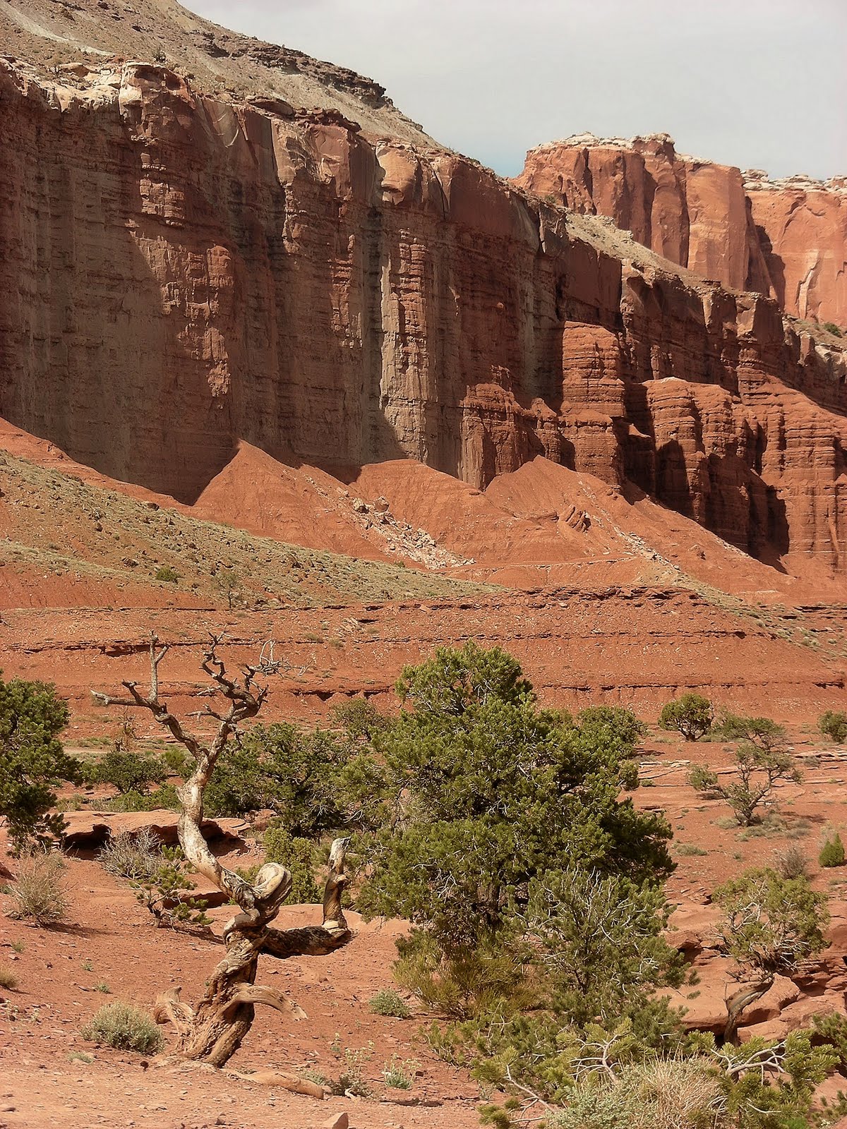


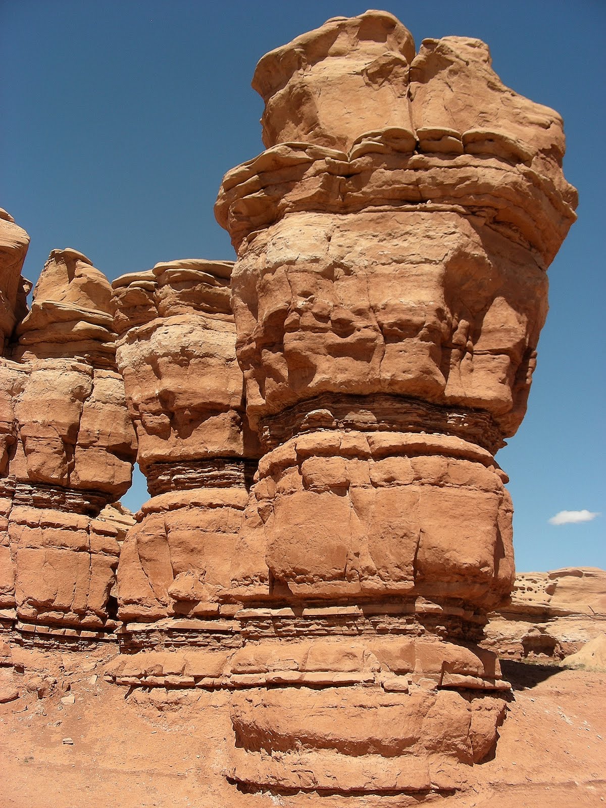
In the Slickrock Divide section of the park, the chocolate colored, strongly layered Moenkopi Formation has eroded into spires and hoodoos that I just couldn't stop photographing.
As in most other areas of the park, the wildflowers were blooming profusely here.


This was one of the two most wondrous plants I saw in the park. I don't know what it is, but the white scaffolding, which was probably last year's growth, seems to protect the new growth underneath.

After the Slickrock Divide, we spent an hour or so at a small turnoff called Panorama Point/Goosenecks Overlook. As Sulfur Creek enters the park from the west, it has cut a deep, meandered canyon into the Waterpocket Fold. Clearly, Sulfur Creek was flowing here as the Waterpocket Fold was uplifted, and it just incised its Goosenecks meanders deeper and deeper as the land rose higher and higher.We also took some photographs at Panorama Point. Doesn't every park have a Panorama Point?

Thursday, July 8, 2010

Capitol Gorge, Capitol Reef

Multicolored sandstone strata in the walls of Capitol Gorge
(unretouched, honest!)

The western entrance to Capitol GorgeCan you believe this was once the main road through Capitol Reef in the early 20th century?

Only three canyons penetrate the Waterpocket Fold allowing east-west passage without having to ascend and descend hundreds of feet over all-but-impassible terrain: the Fremont River Canyon, the contemporary route bearing UT 24 through the reef, Grand Wash (watch for a post in a few days), and Capitol Gorge, the preferred route in the early 20th century. At that time, the bed of the wash was cleared of boulders and cars regularly attempted the "road."

Today, Capitol Gorge is the location of a 4-mile hiking trail that allows walkers to penetrate through the heart of the Waterpocket Fold. Most hikers start at the western end and hike two miles into the gorge, where a side trail leads to some of the namesake waterpockets, or tanks. Along the way, hikers can enjoy Native American pictographs, a trail registry carved into the cliff wall by early travelers, and a profusion of wildflowers, especially in early spring, when we visited.


Despite the area's aridity, Capitol Gorge was carved by water. High up on one of the walls was an alcove carved by flowing water bearing boulders that ground out a little hollow. I don't know if these grinding boulders have remained in that alcove for the many thousands of years since the floodwaters eroded the main channel six feet deeper, leaving the alcove and the boulders high and dry above the bed of the wash, or whether they were tossed there by tourists playing basketball with stones.


Detail of sediments exposed in the sandstone cliff wall

One of the namesake waterpockets (lower right)

First Katydid, High Summer

I heard the first katydid of the summer last evening just as the sun was setting. In addition, I noticed that the deep purple New York Ironweed (Vernonia noveboracensis) flowers have appeared in the wet meadow in my favorite natural area. High summer is fully upon us here in the sweltering Mid-Atlantic. Unfortunately, for the last few days, it's been so hot and humid I have been keeping the air conditioner on and the windows closed, so I can't hear the katydids singing at twilight.

Firefly numbers are dwindling, too. I think they peaked early and then experienced a precipitous decline during the last week. I recall that fireflies used to be abundant until the end of July, but if current trends prevail, they'll be all but gone by the end of the month this year.

I wish that the same could be said of the mosquitoes, which seem to be doing just fine despite the bone-dry, rainless conditions.

Tuesday, July 6, 2010

Hickman Bridge, Capitol Reef

Western Tanager (Piranga ludoviciana) along the Fremont River
Capitol Reef National Park

Capitol Reef is the least visited of the six national parks in southern Utah. I don't understand why. Its scenery is as spectacular as the others, and it's located along Utah S.R. 12/24, which links Bryce Canyon to Arches and Canyonlands. The park's lack of popularity was fine with us, since it just meant the possibility of more serenity. While it wasn't a madhouse like Zion and Bryce can be, the park was hardly deserted.

The park was established mainly to protect the 100-mile-long Waterpocket Fold, a massive swell (monocline) in the earth's crust that formed while the Rocky Mountains were being uplifted. A monocline is a regional fold with one steep side in an area of otherwise nearly horizontal sedimentary layers; a monocline is a "step up" in the rock layers. Rock layers on the west side of the fold have been lifted 7,000 feet higher than those one the east side, but erosion over the last 20 million years has removed most of the uplifted rock so that the difference in the contemporary landscape is only several hundred feet between west and east. The Waterpocket Fold is the largest and longest monocline in North America and one of the largest in the world.
The Waterpocket Fold gots its name because it is a "fold" in the earth's crust, and because rainwater collects in sandstone basins in the rocks (i.e., waterpockets), creating pools that support wildlife throughout the year. The park's name comes from the fact that the Mormon pioneers who first visited the area thought that one of the eroded sandstone domes looked like the recently completed United States Capitol building in Washington, and the geologic formation, which formed a formidable barrier to east-west travel, resembled an ocean reef.
For our first day-hike in the park, we decided to tackle the Hickman Bridge Trail, the most popular in the park. The trail leads along the Fremont River, then heads into the hills above the river to Hickman Natural Bridge.
White sandstone, black basalt glacial erratics, and green grass along the trail to Hickman Bridge
Hickman Natural Bridge is visible from quite a distance away
After visiting the bridge, we retraced our steps down the trail and back along the Fremont River. In the riparian cottonwood trees along the river, we came across the very accommodating Western Tanager pictured at the beginning of this post. We saw quite a few Western Tanagers during our trip, but none that cooperated for a portrait like this one did.

Winter's Bone

Seventeen-year-old Ree, forced to drop out of high school in order to take care of her mentally ill mother and her two younger siblings, is faced with an even more serious problem when her absentee, methamphetamine-cooking father uses the family's Missouri homestead to cover his bail bond. And, daddy's unlikely to show for trial, so the property is all but lost. In desperation, Ree begins to search for her father to try to make him show for his trial. In the process, she must rely on the network of her large, extended family living in the Ozark hill country, most of whose members are hostile to her desperate situation.

A mystery as stark and spare as the rocky Ozark oak forest in which it is set, Winter's Bone succeeds best as an amazing character study of Ree and her kin, isolated, suspicious, and stricken with poverty.

There's also an incredible sense of place here, too. Ree's despair over losing the homestead--in addition to the fact that she and her family will be homeless--is further exacerbated by her awareness that the 100-year-old oak forest that has sustained her family for generations will be cut down for timber.

Winter's Bone was awarded several prizes at the Sundance Film Festival, and for good reason.

Friday, July 2, 2010

Summer's Official

Diceroprocta vitripennis, an annual cicada photographed in Mississippi
Image by Paul Krumbholtz, cicadamania.com

I heard the first of this summer's cicadas on Wednesday evening, June 30, during a walk in my favorite natural area. Summer's finally here in my part of the the Mid-Atlantic (as if the infernal weather wasn't enough of a clue).

Thursday, July 1, 2010

Notom-Bullfrog Road en route to Capitol Reef

Along the Notom-Bullfrog Road

Traveling from Boulder, Utah, and driving east, the Burr Trail Road crosses a low point in the Waterpocket Fold (more on that in the next post) and descends down a long series of steep switchbacks on a well-graded dirt road. The Utah guidebooks all made the switchbacks sound treacherous, and maybe they are in inclement weather, but I've driven on far worse flat and straight roads.

At the bottom of the switchbacks, the Burr Trail Road joins the Notom Road coming in from the north and the co-joined roads heads south to the Bullfrog marina on Lake Powell. Instead of heading south to Bullfrog, we turned north toward the ranching settlement of Notom (pronounced NOTE'm) and Capitol Reef National Park.

The Henry Mountains from the Notom-Bullfrog Road

The Notom Road is graded gravel for about 30 miles. To the west looms the Waterpocket Fold in Capitol Reef National Park; to the east, the still-snowy volcanic Henry Mountains are omnipresent in the distance. The first five or six miles crossed beautifully eroded mudstone and siltstone badlands; in places, the rock was variously shaded purple. Further north, though, the topography near the road became less interesting, but the roadsides featured plenty of wildflowers in spring bloom--my main motivation for driving the Notom Road.


Near Notom, the road approaches a photogenic sandstone butte before it joins Utah 24, the main east-west route through Capitol Reef National Park.