Wednesday, July 30, 2014

Misty's Incomprehensibly Stupid Owner


Striped skunk (Mephitis mephitis)
Perhaps this story properly begins last Saturday (July 26).  That morning, I walked up to fill the bird feeders and noticed a very wobbly skunk along the path.  Though it appeared to "rally" while I watched, the animal soon toppled over on its side and lay still, bedeviled by flies and wasps.  Within an hour it was stiff, and I moved the carcass to the compost pile so that visitors wouldn't encounter a dead animal.  (Incidentally, on Sunday morning, the carcass had disappeared from the compost pile, but that's not important for this story.)
Groundhog or Woodchuck (Marmota monax)
Last evening (July 29), our organization hosted a perennially popular beekeeping program.  We expected about 40 participants to arrive around 6:30.  As I was bustling about in preparation for the program, a walker told me that there was a yearling groundhog in our parking lot behaving very strangely, and that some program participants were afraid to get out of their cars.  Sure enough, the groundhog clearly was seriously ill.  It would walk ten or fifteen steps, and then it would topple over as if it had lost control of its legs.  Then it would get up and repeat the behavior over and over.  In addition, instead of running away from people, it ran toward people - sometimes surprising rapidly.  With the large group expected I had to do something, so I called the police and asked them to put the animal down.

While I was waiting for the police to arrive, a visitor drove into the parking lot with his passenger side window open.  His Australian shepherd's head stuck out of the window.  The driver slowed  when he saw the groundhog and he closed the passenger side window.  The driver and I spoke briefly about the sick groundhog, and I mentioned that the police were en route to euthanize the animal.  The visitor and his dog drove out of the parking lot and left the preserve.

The police took a long time to arrive.  I know that a sick groundhog is not on par with a bank robbery, but our preserve is located less than 10 minutes from the police station, so I expected the officer's arrival at any minute.  Meanwhile, I followed the groundhog so that (1) I would know where it was when the officer arrived and (2) I could warn people to steer clear of the animal.  All the while, mosquitoes feasted on my bare legs.

About 30 minutes after I called the police, the driver with the dog drove back into the parking lot.  I reiterated to the driver that the police were on their way and that I expected them very shortly.  The driver then parked his car.

I should mention that, although we don't allow dogs in most parts of our preserve, there are places where dogs on leashes are permitted and it is possible to walk from our parking lot on lightly-traveled public roads to get to the portion of the preserve where dog walking is permissible.  Furthermore, there is a 30-acre open field across the street from our headquarters where people routinely walk and train their dogs, and dog owners often park in our lot and walk over to this field.

So, when the driver with the dog parked his car and opened the door to allow his dog out, I wasn't surprised.  However, instead of walking toward the parking lot exit or toward the open field across the street, the driver and his dog (which was not leashed) began walking toward me and the groundhog.  At first, I couldn't figure out what the guy was doing, then I was momentarily stunned as he and his dog continued to approach me.  After a few seconds, I said to him, "You know, sir, dogs are not allowed on this property, and dogs must be leashed when you walk where dogs are allowed."  He replied, "Oh, okay," as he continued to walk toward me.  Just at that moment, the dog spotted the groundhog and tore off, hell bent for leather.  Also at that very moment, the police arrived in the driveway.

As you might imagine, pandemonium ensued.  The hapless and utterly disoriented groundhog attempted to escape by running under a car, pursued by the dog.  The dog owner kept screaming, "Misty! Get away from there! Get away from there!" all to no avail whatsoever.  This dog had its quarry and it was not going to give it up.  Eventually, Misty grabbed the groundhog and shook it, but didn't kill it.  The owner finally got physical control over Misty, loaded her in the car and sped out of the parking lot.  The police officer, incredulous after watching the whole scene, shot the groundhog with his pistol.

As I expected (and hoped), the officer told me that he would have to take the groundhog in for testing to determine if it was rabid.  I asked the officer to let me know if the test came back positive.  (There was a confirmed rabid bat in our neighborhood two weeks ago.)

For Misty's sake, I certainly hope that she had been vaccinated for rabies.  If not, and if the groundhog was rabid, she almost certainly will contract the disease.  I had never seen this irresponsible dog owner before - he wasn't one of our "regulars" - so I can't contact him if the groundhog tests positive.  A thoroughly upsetting and all around unpleasant experience.
Monday, July 21, 2014

Patterns and Textures: Chanticleer Redux


Kali doesn't have to work on summer Fridays (though she has to make up the time by working long hours Monday-Thursday).  Last Friday's weather was forecast to be tolerable for outdoor activities, with broken clouds, highs in the mid-80s, and low humidity.  So, I took a vacation day and Kali and I made our annual pilgrimage to Chanticleer Gardens outside Philadelphia.

I've posted images of Chanticleer before - and Kali chided me for taking more photographs on this trip ("Do you know many pictures you have of this place?"), so I tried to concentrate mostly on textures and patterns during this visit. 
"Chanticleer" adorning the former estate house
In the Courtyard Garden

Pitcher plants in the Bog Garden (the hapless leafhopper was still alive)
In the Water Garden
These blooms were very fragrant, but Kali and I couldn't agree on what they smelled like.  I got a distinct odor of licorice or anise, but she disagreed.

Spring run
Bumblebee on teasel bloom

Walkway detail (stone and brick)
In the Ruins Garden
Kali on a whimsical bench in the Vegetable Garden
Chanticleer never fails to captivate us, and it was no different this time.

Friday, July 18, 2014

At the Headwaters


At the headwaters of my creek
My preserve is located in the center of the watershed drained by the creek flowing through the preserve.  Downstream of my preserve, the creek's floodplain and some of the adjacent steep slopes are pretty well protected in county and city parks.  But upstream of my preserve, the watershed has largely been built out in typical suburban style.

As a result, the biggest environmental problems with my creek are related to stormwater runoff from the impervious surfaces upstream of my preserve.  Stormwater generates problems like erosion, sedimentation, turbidity, flooding, and low stream baseflow between storms (because precipitation runs off impervious surfaces and does not have a chance to filter into the ground to recharge springs).

One of the largest Philadelphia-area philanthropic foundations recognizes these problems in my and my neighboring suburbanized watersheds, and the foundation has begun a multiyear, $37 million initiative to begin to address these problems.  On Tuesday, I learned that our organization had been awarded a $165,000 grant to create a stormwater detention wetland at the very headwaters of my creek.  The wetland basin will intercept the runoff from a 40-acre housing subdivision, infiltrate part of the water, and trap sediments, thereby improving water quality in the creek (we hope). 
Project manager (center) pointing out details of the project
Though my organization was awarded the grant, we will be building the wetland project on another non-profit's property: a summer camp for economically disadvantaged children.  The camp, which has a strong environmental education component, will use the wetland to teach children about the importance of stormwater management.  At 235 acres, the camp is the largest natural area upstream of my preserve, and it's located right at the headwaters of my creek.
A representative of the foundation (in pink, on right) explaining  the foundation's goals
On Wednesday, July 16, project engineers, university scientists, and a representative of the philanthropic foundation that is paying for the project visited the site - currently a wet swale in a meadow.  We'll be starting work on the project in the next few weeks.

I'm not overly excited by this project because (1) it's not in my preserve (where there's already plenty to do), (2) it's not going to make much of a difference in terms of water quality in a 56-square-mile watershed, and (3) there's almost no money in the tight budget for project administration.  However, it gives our organization good "press," receiving the grant makes me look good to my board of directors, and the project is a step in the right direction for the watershed, so I'll take it.
Departing the site.  There are worse places for a walk on a sunny summer afternoon.

Thursday, July 17, 2014

For Mark Paris (with apologies to everyone else)

Mark:  WordPress will not let me leave comments on CaniConfidimus.  When I write a comment and then press the Submit Comment button, the screen comes back as a blank Comment page, and the comment I had just written about your post does not appear attached to your post.  I don't know what's wrong.  I'm continuing to follow you and Leah diligently and didn't want you to think I had stopped, but I can't comment to you.  I didn't know any other way to get in touch, so I'm doing it "publicly;" when I've heard back from you, I'll delete this post.  Do you know what's wrong?

Monday, July 14, 2014

Summer Snowstorm


Look carefully for the "snowflakes" against the dark trees in the background
We're experiencing a "snowstorm" in my preserve this month.  Non-native Canada thistle (Cirsium arvense) (a real misnomer and a "slight" to Canada since this thistle is actually a native of Eurasia) has exploded in our grasslands.

The culprit in flower
All stages -  from flower to fluff
The incredible infestation is the result of a perfect storm of unfortunate events.  First, our boom sprayer was out of commission in the spring so our land manager couldn't spray the thistle when it was most susceptible.  Second, the herbicide we've been using to try to control the thistle, Transline, seems to be losing its effectiveness, so we're going to have to find an alternative.  And third, by the time we realized the mess we were going to be in, migratory birds and rabbits had begun to nest in the fields, so we couldn't mow the thistle to prevent it from going to seed.
A patch with countless seeds
Non-native wineberry (Rubus phoenicolasis) cloaked in thistledown
Everything in the fields that's not green is thistle
One silver lining to these thistledown clouds: the American Goldfinches (Carduelis tristis) are having a field day (so to speak) feasting on the abundance.

Friday, July 11, 2014

Fern Creek Falls in Forest Canyon - Rocky Mountain National Park

Kali at The Pool, Big Thompson River
After four days in Colorado Springs, Kali and I drove north to Fort Collins, mostly to tend to our house in the foothills.  One day during our stay in Fort Collins, though, we drove to Rocky Mountain National Park for a rather ill-fated hike.  I'll spare most of the "gory" details, but the drive to the park was clogged with traffic, the park was crowded, parking was at a real premium within the park so we had to park at a picnic spot 0.5-mile from our intended trailhead, the day was hot, and Kali wanted to take a 30-minute nap before we set off all while I'm watching the thunderheads building up over the mountains.  (Kali perceived my irritation and agitation and decided to forgo the nap.)  I was not a happy camper when we set off on the hike.

I'd chosen a moderate, 5-mile round-trip hike up Forest Canyon to Fern Creek Falls.  With the additional walk to the trailhead from the remote parking lot, it turned into a 6-mile hike.
The trail into Forest Canyon
The hike was mostly though coniferous forest that pressed in from both sides.  There were a few breaks in the vegetation where we could look over the Big Thompson River roaring through the canyon, but mostly we just walked steadily uphill through the woods.

Kali between a rock and a hard place
The Big Thompson River at the edge of a burned patch of forest
Our first highlight along the route was The Pool, a place where the raging Big Thompson River broadens out (slightly) into a stretch of water that is smoother but still moving at an incredibly fast rate.
Footbridge over the Big Thompson River at The Pool
The Pool on the Big Thompson River - not a pool in which I'd choose to swim
Larimer County Youth Conservation Corp members at lunch below The Pool
After staring mesmerized at the torrent for a few minutes, we set off to see Fern Creek Falls on a tributary stream.
Ascending the Fern Creek Trail
Above The Pool, the trail narrowed considerably and was much more rocky, uneven, and steep than the heavily-traveled trail to The Pool had been.  Kali was becoming increasingly grumpy, and I started out grumpy, so we made a fine pair.  When we got to Fern Creek Falls, I stopped for a few minutes to take pictures, but the mosquitoes were ravenous so we didn't tarry long.  In addition, it started to rain almost as soon as we got to the falls, so we quickly donned our raincoats.  After a few minutes, the rain passed and we stowed the raincoats again.

There were many hikers schlepping backpacks who were continuing up the trail to Fern Lake and several other lakes in the higher country.  Both Kali and I had the same thought:  "Mosquito misery!"
Kali at Fern Creek Falls
Another view of Fern Creek Falls
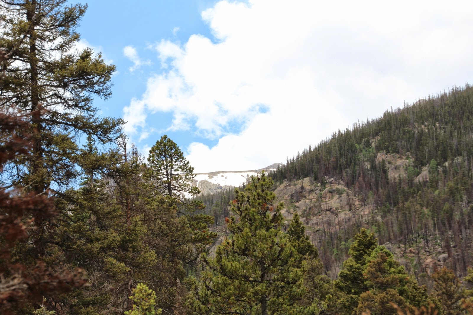
Because we weren't going to get to a good place to view the snow-clad summits of the mountains, I took one shot of a snowy ridge peeking between the trees.
A glimpse of the snowfield above Fern Creek Canyon
Rock garden in greens
Rock garden in blues and golds
After I took some images of Fern Creek Falls, we hiked back to The Pool for lunch.  En route, we ran into the Youth Conservation Corps workers - a visibly less-motivated group of young people would have been hard to find.  Back at The Pool, we were greeted by packs of ground squirrels.  Do you think the hikers give them handouts?
Soooo cute...
We tossed this individual a sweet cherry
I guess if the touristas won't give me a fat, greasy and sweet handout I'll have to eat salad
After lunch, we headed back toward the trailhead - and we had an encounter that redeemed the entire trip.  As we were walking alongside the Big Thompson River, I noticed a long, dark, sleek form moving rapidly upstream on the riverbank just a few feet from the trail.  I called out for Kali who was a dozen paces ahead of me on the trail and we raced back up the path just in time to see a mink dive into the current and come back to the shore with a fish in its mouth!
Rock garden at trail's end
Here endeth my account of our Colorado getaway for this year.

Thursday, July 10, 2014

North Cheyenne Canyon


Helen Hunt Falls
After Kali and completed our hike at Mueller State Park (see previous post) about an hour west of Colorado Springs, we headed back into town to shop for Southwest Indian jewelry at the Garden of the Gods Trading Post.  This establishment, located adjacent to the southwest corner of Garden of the Gods Park but not affiliated with the park, has been a fixture since 1907.  The building is huge and the majority of store is an unspeakably tacky souvenir shop.  But an addition at the back of the store (dubbed the "art gallery") contains high quality artwork and jewelry in a refined setting.  Kali had been looking for some "boulder turquoise" jewelry for herself and for a colleague, and the trading post had the best selection we'd yet seen during our travels.  ("Boulder" turquoise is turquoise still embedded in some of its native mother rock, so jewelry made from boulder turquoise tends to have brownish or greenish mother rock shot through with dramatic streaks of sky-blue turquoise.  It's very attractive if well-designed.)  Kali bought a pair of earrings for her colleague and an earring-necklace set for herself.  Very classy.  Our salesperson, a transplant from Lansing, Michigan, was a wonderful, warm, funny and helpful person; I felt great about the whole transaction when we left. 

When we had completed our shopping, we still had a few hours left before dinnertime, so Kali asked if I wanted to tackle a hike at Garden of the Gods.  I told her that I had another idea, and we set out for North Cheyenne Canyon, another Colorado Springs city park set in a deep, narrow eponymous canyon.  At the head of the canyon are two waterfalls:  Helen Hunt Falls and Silver Cascade (or Spoon) Falls.  Helen Hunt Falls, named for a Colorado Springs writer and abolitionist who loved the canyon, is immediately adjacent to the road and has been "loved to death."  It was challenging to get the image of the falls accompanying this post because, most of the time, the falls is festooned with kids.  Helen Hunt's earthly remains originally had been buried near the falls in the canyon, but she was so beloved that her grave site was constantly overrun by people paying their respects, so her family had her remains interred elsewhere.  Poor Helen.  
The stream above Helen Hunt Falls
Silver Cascade (or Spoon) Falls is located at the top of a short (0.3-mile) but very steep trail above Helen Hunt Falls.  The drastically overused trail is in terrible condition, with water bars and wooden steps installed by the city long ago knocked out of place and the trail itself an eroded and trampled gully, but we joined the throngs slogging their way to the top.  Silver Cascade is more of a long slucieway over a huge slab of tilted rock rather than a free-falling waterfall.  It gets its nickname (Spoon Falls) because midway down the slope a rock juts up into the flow, and when there's enough water sliding down the slab this rock forces the water into a fan (the naturalist at the park called it a "rooster-tail") or a "spoon" of water.  There wasn't enough water flowing to create the "rooster-tail" when we visited, and the falls wasn't even impressive enough to photograph.  
View northeastward down North Cheyenne Canyon toward Colorado Springs and the prairie
Nevertheless, the view down North Cheyenne Canyon to the city of Colorado Springs and the plains beyond was almost worth the grueling climb to the top.

I wonder what Helen Hunt would think of North Cheyenne Canyon today.  Perhaps she'd be glad it was protected as parkland (even if it is swarming with people) rather than developed with McMansions with "million dollar views."

Wednesday, July 9, 2014

Back to the High Country (Mueller State Park)


View eastward toward a ridge extending from Pike's Peak
Overnight, Kali and I got over our tiff about not hiking the previous afternoon (see previous post).  The next morning, after breakfast, I proposed a hike at Mueller State Park, back in the high country west of Woodland Park, Colorado.

Mueller State Park is a relatively new Colorado state park, having been cobbled together from several ranches.  The park road turns west off of the north-south state highway south of Divide, Colorado, travels about a mile into the heart of the park, then turns sharply north to provide access to campgrounds and trailheads.  The beautiful new Visitor Center is located on a high point at the sharp bend in the road.

We stopped at the Visitor Center to get oriented and to ask for hiking suggestions.  I jokingly approached the ranger with the question, "Can you recommend a 5-mile hike with great scenic views and waterfalls?"  To my amazement, she replied, "I sure can (sort of)!"  She sketched out a route that included several scenic viewpoints and the canyon of the only perennial watercourse in the otherwise high, dry and arid park.
Kali at Raven Ridge Overlook looking southward
View eastward toward the northwestward shoulder of Pike's Peak
Another view southwestward from Raven Ridge
One downside to hiking at Mueller State Park is that the park access road leading to the trailheads is located on the crest a high spine that runs north-south through the park.  As a result, every trail starts off heading downhill (some for quite a distance).  Hikers have to pace themselves because the end of every hike is going to be an uphill climb to return to the trailhead.  This is especially important for hikers who haven't yet acclimated to the 8,500-foot elevation.
Geer Pond, where we were greeted by a pair of Mallards
Kali on the trail below the Geer Pond dam
Between Geer Pond (above) and Rock Pond (below), we made our way downward through the steep canyon of the only perennial stream in the entire park.  In terms of volume, it wasn't much of a stream, but it had carved a small canyon lined with gigantic boulders.  At the bottom there was a very modest waterfall where the creek spilled over one of the boulders.  Most of the birds we heard in the park were concentrated in the canyon.

Rock Pond - aptly namedAll of the numerous ponds in the park are old ranch ponds behind dams
Through an aspen grove
Elk-gnawed aspens
The ranger at Florissant Fossil Beds National Monument the day before had told us that elk gnawed the bark of aspens for the aspirin precursor chemical the bark contains.  He said that elk cows were especially prone to gnawing the bark in advance of labor to dull the pain.  He certainly may be right, but I suspect that elk gnaw the bark during the winter for food, too.  

Nearly all the trails through the park are located on the ranch roads that used to criss-cross the land that is now park.  However, the state parks folks have done an excellent job of converting the roads to trails and of maintaining those trails, which, for the most part, are more like wide pathways than old roads.  In addition, all of the trails are very well marked and corresponded exactly to the trail map.
Dead wood
Kali loves to make images of photogenic dead wood.  She took several image of this log before turning the camera back to me.  This image is actually one of mine (not hers).  It's not the best of images, but it's satisfactory, in my opinion.  Unbeknownst to me, earlier in the hike I had inadvertently hit a button on the camera that made the self-focus sensor use just one point in the visual field for a focus; as a result, most images of the log were not worth saving.

Our hike at Mueller State Park was actually the most pleasant hike we completed during our visit to Colorado this year.  The trails were well-maintained, were not too steep (because they were old ranch roads), and were well-marked.  The scenery wasn't "national park" spectacular, but we enjoyed the abundant wildflowers, the ease of walking, and the cool breezes sighing through the evergreens.

We returned from our hike just as the skies opened up with a torrential mid-summer mountain downpour.  Great timing!