
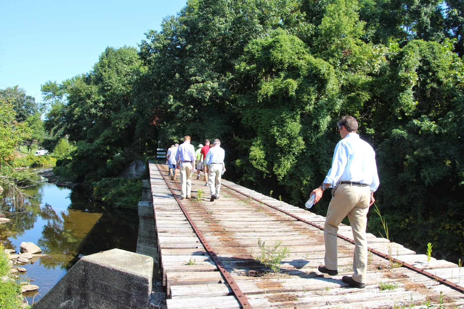
 |
| Traversing a trestle spanning my creek at the southern end of my preserve |
The line was carrying passengers until 1984, when the local regional rail authority suspended service because of low ridership. When service stopped, the rail authority abandoned the right-of-way, which mostly became overgrown with vegetation. Walkers kept a casual trail open along the right-of-way by wearing a path, but the edges of the rail line became a jungle - which was fine with me.
Then, our county decided that it was going to turn the right-of-way into a trail. They began by removing the rails and ties along a 2-mile section of the right-of-way that ran through a county park downstream of my preserve. Now, the county is extending the trail northward through my preserve. This extension has caused a great deal of consternation among my board members, but the county is moving ahead non-stop, and the trail, whether we like it or not, will be complete by next summer (2015). We're concerned that mountain bicyclists and dog walkers will ignore the trail use limitations in our preserve and will require considerable patrolling. On the other hand, the secluded rail corridor had been a site for vandalism, drinking and drug use, so the trial could have some positive impacts, too.
On Wednesday morning, August 27, a group of people from the county, two local municipalities, and our organization walked the length of the new trail route to point out areas where we anticipate there could be problems so that the county could plan accordingly. I present some images from our walk.
 |
| The trail route through the southern end of my preserve |
 |
| Estimating the width of the final trail |
 |
| Purple loosestrife (Lythrum slicaria) and rose-mallow (Hibiscus moscheutos) along the trail |
 |
| Approaching the post office/train station in the historic district at the edge of my preserve |
 |
| My creek just upstream from the post office |
 |
| Crossing another trestle over my creek (there are three trestles in my preserve). House on the right is private. |
 |
| My creek viewed upstream from the trestle, above |
 |
| A green tunnel |
 |
| An historic stone-arch road bridge over my creek, now part of our trail system and off limits to traffic. This is the second-oldest bridge in our county (1840). |

5 comments:
Hmmm. The proverbial two-edged sword, eh, Scott? That last guy in the first image looks as if he's afraid of falling between the cracks.:)
The New Mexico Rails-to-Trails Association has done a lot of outstanding work converting the beds of old railroad lines into desirable trails. Several that we frequently use in the High Rolls/Mountain Park area are just such trails.
P.S. I now know where "your" preserve is, Scott. In the short time I've been following your blog I don't think I've ever seen mention of it.
This sounds like one of those good-news, bad-news situations. I like the idea of walking trails, and rails to trails specifically. But I can also appreciate your concern about what might happen in your preserve. I hope it works out OK.
Packrat: Our county has created at least 30 miles of trails on old rail beds in the last 20 years. The trails are top-notch and a real recreational asset. But, none of the trails pass through private natural areas like ours. They do traverse public parks that were set up for high user volume and large crowds, but our preserve was set up for conservation and limited public use.
We used to have a real problem with mountain bike riders on our trails. Over time, we solved that problem by constantly telling the bikers that they were not welcome in our preserve and that we'd call the cops to enforce the use restrictions if they didn't behave. They finally got the message. I just hope this doesn't open the floodgates again.
With regard to your second comment, I intentionally never was specific about the location of my preserve. I decided, when I started to blog, that it would be better if people didn't know exactly where I'm located. Now, in retrospect, it doesn't seem to make any difference.
Mark: In the long run, I think things will work out just fine along this trail, but the first few years might be a little rocky and contentious. I can tell you that, personally, I'm really looking forward to the trail's completion; then I can ride my bike five minutes to get on the trail and ride 15 miles completely off road. Now, I've got to put my bike in my van, drive 15 minutes to a trailhead (on the same trail), and then start my ride.
Post a Comment